From a scheduled prehistoric wedge tomb and a medieval church site to the motte, schools, community landmarks and the living landscape of Mallusk and Hydepark, the history of this district is layered into the ground around us.
Interactive heritage explorer
Discover the places behind the stories
The explorer now follows the local orientation more closely: Roughfort is shown in the upper part of the landscape, with Mallusk and Hydepark below and to the south-east. Select a numbered marker to open the research record for that place.
A recorded wedge tomb in Craigarogan, also known in the archaeological record as Carn Greine, Granias Grave and Granny’s Grave. It is one of the oldest known heritage sites in the Roughfort landscape.
Recorded ecclesiastical siteSMR ANT051:042 · Grid J2696084060
The recorded site of a medieval church and graveyard at Roughfort/Craigarogan. The old graveyard is also identified on nineteenth-century Ordnance Survey mapping.
The surviving motte is part of the medieval landscape of Roughfort and remains one of the clearest historic features from which the settlement takes its name.
Recorded battle siteSMR ANT051:156 · Grid J2704084000
The Northern Ireland Sites and Monuments Record identifies a battle site dated 1567 in the Craigarogan/Roughfort area. RHCPS will treat this as a research point while gathering further documentary context.
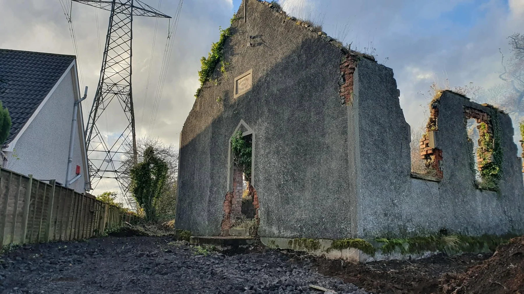
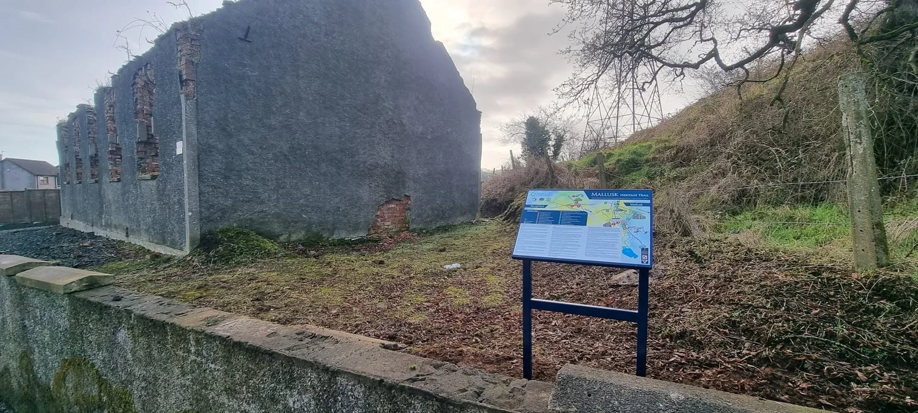
Opened in 1898, the hall served worship, meetings, music, remembrance and community life for almost eight decades before the fire of 1977. Its surviving walls remain part of the local landscape.
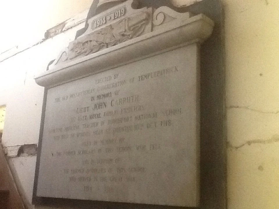
Historic mapping records a National School and Craigarogan School in 1857 and Roughfort Primary School in 1901. The former schoolhouse also preserves the memory of Lieutenant John Carruth.
A circular cropmark recorded from aerial photography in Craigarogan. Its date and function remain uncertain, making it an important research point rather than a fully interpreted monument.
An elliptical cropmark in Craigarogan recorded from aerial photography. Like the nearby circular cropmark, its archaeological period is currently uncertain.
Mallusk and Hydepark sit lower down the local landscape from Roughfort and are closely tied to the area’s schools, churches, memorials, community organisations and heritage trail.
SMR ANT051:067 records an Early Christian souterrain in Craigarogan/Roughfort, but the site is unlocated. It is therefore deliberately not shown as a precise marker.
Scheduled monumentRecorded SMR siteHistoric map featureUncertain / research site
Marker positions are designed for orientation and storytelling, not legal boundary or survey use. Archaeological references shown here are drawn from the Sites and Monuments Record information collated by RHCPS; uncertain or unlocated sites are identified as such.
A landscape shaped over centuries
Roughfort through time
A visual route through some of the key periods currently represented in RHCPS research and local heritage material.
01
Neolithic / Bronze Age
Cairn Greine / Granias Grave
A scheduled wedge tomb in Craigarogan preserves one of the earliest recorded layers of the Roughfort landscape.
02
Medieval period
Church, graveyard & motte
The recorded medieval church and graveyard site and the Roughfort motte show that this small area held important settlement and ecclesiastical activity long before the modern village.
03
1567
Recorded battle site
The Sites and Monuments Record identifies a battle site dated 1567 in Craigarogan. RHCPS is retaining it as an active research point while further context is assembled.
04
1798–1799
Rebellion & the Liberty Tree
Roughfort became connected with the history of the United Irishmen, while the Liberty Tree is traditionally associated with the first anniversary of the 1798 Rebellion.
05
1857–1901
Schools on the historic maps
Ordnance Survey records identify a National School and Craigarogan School in 1857 and Roughfort Primary School in 1901, reflecting the long importance of education in the district.
06
1898
Roughfort Orange Hall
The foundation stone was laid in April and the hall officially opened in September, beginning almost eight decades of community use.
07
1914–1919
The Great War
Men from Roughfort, Hydepark, Craigarogan, Mallusk and nearby townlands served across the conflict; local memorials continue to preserve their names.
08
1940s
Wartime community life
The hall continued as a gathering place during the Second World War, including events connected with the Ulster Home Guard and local welcome-home efforts.
09
1977
Loss of the hall
Roughfort Orange Hall was destroyed by fire in July 1977. The surviving walls remain part of the local landscape.
10
2021
RHCPS established
Roughfort Heritage and Cultural Preservation Society was founded to research, protect and promote the area’s heritage and cultural life.
11
2023
Heritage interpreted in place
Community-developed heritage signs were officially launched in Mallusk and Roughfort, helping make local history visible in the landscape.
12
Today
A living heritage
Research, education, remembrance, community programmes and new partnerships continue to add fresh chapters to Roughfort’s story.
Archaeology & recorded sites
What the landscape record tells us
These records help place local tradition alongside formal archaeological evidence. Where a site is uncertain, unlocated or still being researched, the website says so rather than presenting interpretation as settled fact.
01
SMR ANT051:040 · Scheduled
Cairn Greine / Granias Grave
The Sites and Monuments Record identifies this Craigarogan monument as a wedge tomb, with the alternative names Carn Greine, Granias Grave and Granny’s Grave. It is assigned broadly to the Neolithic/Bronze Age and is a scheduled monument.
Type
Megalithic tomb — wedge tomb
Period
Neolithic / Bronze Age
Grid reference
J2704184192
Townland
Craigarogan
02
SMR ANT051:042
Medieval Church & Old Graveyard
A medieval or late-medieval ecclesiastical site is recorded at Roughfort/Craigarogan. The record identifies the site of a church and graveyard, while nineteenth-century mapping also records the location as the Old Grave Yard.
Type
Ecclesiastical site
Period
Medieval / Late Medieval
Grid reference
J2696084060
Historic map reference
OS/6/1/51/2 · 1857
03
Medieval landscape
Roughfort Motte
The Roughfort motte is one of the area’s most visible historic earthworks and is thought to date from the medieval period. It forms a major part of the settlement’s landscape story and later became associated with local memory of the United Irishmen and 1798.
04
SMR ANT051:156
Recorded Battle Site, 1567
The Sites and Monuments Record includes a battle site dated 1567 in Craigarogan. RHCPS is retaining this as a research point while further documentary evidence and historical context are assembled.
Type
Battle site
Period
Post-medieval
Grid reference
J2704084000
Status
Located
05
Aerial archaeology
Two recorded cropmark sites
Two aerial-photography sites are recorded in Craigarogan: a circular cropmark (ANT051:112) and an elliptical cropmark (ANT051:113). Their period and function remain uncertain, so they are best understood as archaeological research clues rather than interpreted monuments.
ANT051:112
Circular cropmark · J2654084200
ANT051:113
Elliptical cropmark · J2667084290
Period
Uncertain
Status
Located
06
SMR ANT051:067 · Research note
An unlocated souterrain
An Early Christian souterrain is recorded for Craigarogan/Roughfort, but its precise location is not known. For that reason it is deliberately not pinned to a precise point on the heritage explorer.
Type
Souterrain
Period
Early Christian
Grid reference
J2700084000
Status
Unlocated
Education, settlement & community
From the old maps into living memory
07
Historic Ordnance Survey records
Schools of Craigarogan and Roughfort
The historic map record identifies a National School and Craigarogan School in the 1857 mapping, with Roughfort Primary School appearing in the 1901 record. Together they show the long importance of education within this rural community.
The surviving former schoolhouse is also connected with Lieutenant John Carruth, whose memorial remains an important part of the district’s Great War story.
Opened in 1898, the hall became a centre for worship, meetings, missions, concerts, dances, fundraising and community activity until its destruction by fire in 1977.
Its surviving walls, together with the surrounding archaeological and historic sites, make this small part of Roughfort an unusually concentrated heritage landscape.
Mallusk and Hydepark lie lower down the local landscape to the south-east of Roughfort. Their churches, cemetery, schools, community halls and memorials are woven through the same wider story.
The RHCPS heritage explorer keeps that relationship visually clear: Roughfort sits above, with Mallusk and Hydepark below rather than being shown as neighbouring points on an abstract diagram.
Objects, documents and memorials that hold local memory
Historic records become more powerful when they are connected back to the people and places they represent.
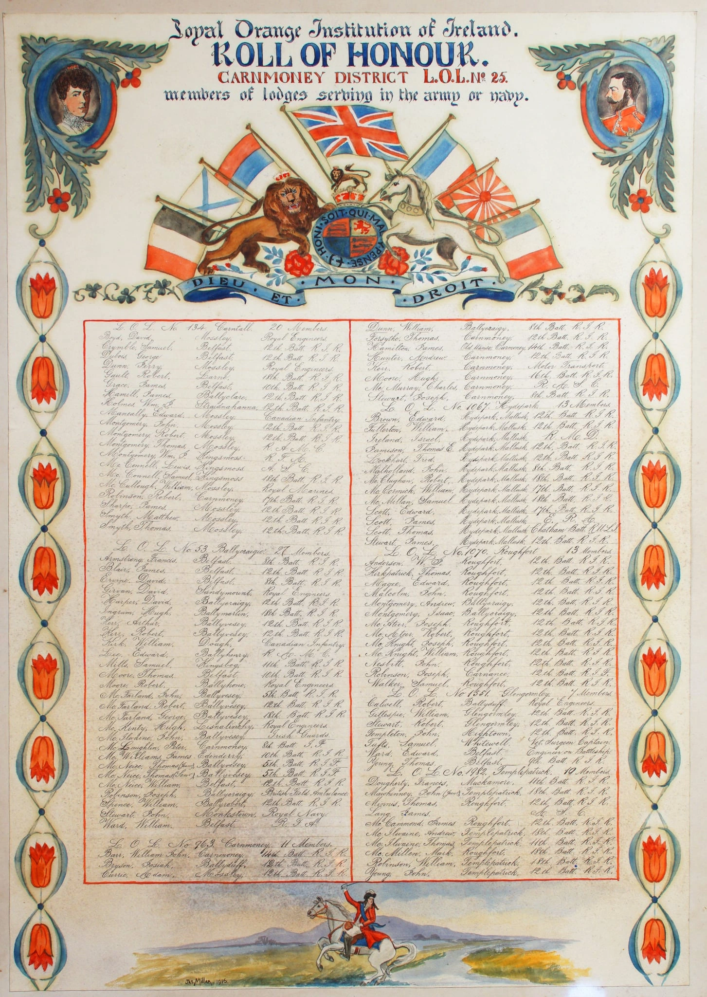
District Roll of HonourA surviving record of servicemen from lodges across the district, including men connected with Roughfort.Explore the Great War archive →Lieutenant John Carruth memorialThe former schoolhouse retains a memorial to its principal, Lieutenant John Carruth, who died of wounds in 1918.Read his story →History in the landscapeThe community-developed heritage sign at Roughfort helps make local stories visible where they happened.Read about the project →
Research transparency
Building the record carefully
RHCPS uses historic maps, Sites and Monuments Record references, archive material, newspapers and local knowledge to build the story of the district. Formal identifiers and grid references are retained where available so future research can be checked against the original record.
As more evidence becomes available, individual heritage entries can be expanded into full articles with photographs, historic map extracts used under the appropriate permissions, and referenced source notes.
Help build the archive
Do you hold a piece of Roughfort’s story?
Family photographs, old programmes, newspaper cuttings, memories and information about local people can all help strengthen the historical record.
If you have material connected with Roughfort, Hydepark, Craigarogan, Mallusk or the surrounding district, the Society would be pleased to hear from you.