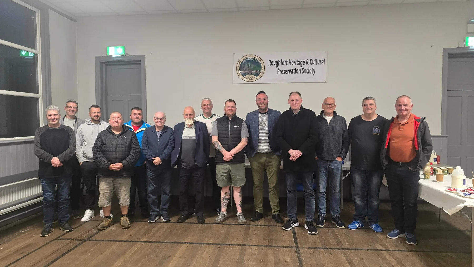
Our community series is underway. Following September’s opening evening with Michael Boyd OBE, two free talks remain at Hydepark War Memorial Orange Hall.
8 Oct Pat McGibbon · 7:30pm12 Nov Gary McAlister · 7:30pm
Free admission · All welcome
106 Mallusk Road, Mallusk. Free refreshments are provided and no booking is required.
Thousands of years of history within a small landscape
Within a short distance of Roughfort are traces of prehistoric burial, medieval fortification, 1798 memory, nineteenth-century community life and the stories of local people who lived through two world wars.
RHCPS researches these places and stories, protects local memory and helps make the area’s heritage accessible to everyone.
Choose a marker to uncover a local place or story. Roughfort is shown in the upper part of the explorer, with Mallusk and Hydepark below, reflecting the local landscape more closely.
A recorded wedge tomb in Craigarogan, also known in the archaeological record as Carn Greine, Granias Grave and Granny’s Grave. It is one of the oldest known heritage sites in the Roughfort landscape.
Recorded ecclesiastical siteSMR ANT051:042 · Grid J2696084060
The recorded site of a medieval church and graveyard at Roughfort/Craigarogan. The old graveyard is also identified on nineteenth-century Ordnance Survey mapping.
The surviving motte is part of the medieval landscape of Roughfort and remains one of the clearest historic features from which the settlement takes its name.
Recorded battle siteSMR ANT051:156 · Grid J2704084000
The Northern Ireland Sites and Monuments Record identifies a battle site dated 1567 in the Craigarogan/Roughfort area. RHCPS will treat this as a research point while gathering further documentary context.
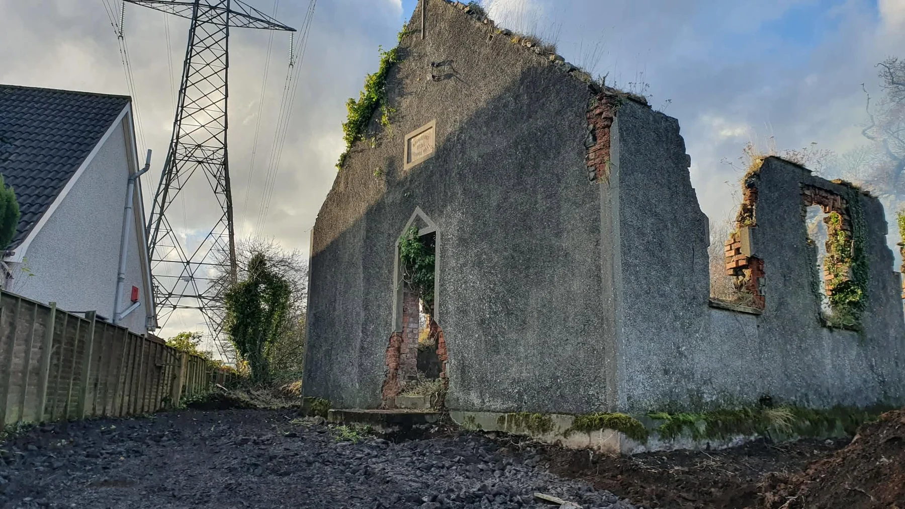
Opened in 1898, the hall served worship, meetings, music, remembrance and community life for almost eight decades before the fire of 1977. Its surviving walls remain part of the local landscape.
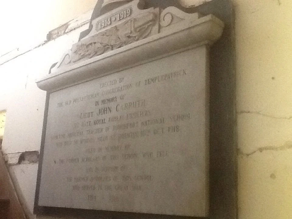
Historic mapping records a National School and Craigarogan School in 1857 and Roughfort Primary School in 1901. The former schoolhouse also preserves the memory of Lieutenant John Carruth.
A circular cropmark recorded from aerial photography in Craigarogan. Its date and function remain uncertain, making it an important research point rather than a fully interpreted monument.
An elliptical cropmark in Craigarogan recorded from aerial photography. Like the nearby circular cropmark, its archaeological period is currently uncertain.
Mallusk and Hydepark sit lower down the local landscape from Roughfort and are closely tied to the area’s schools, churches, memorials, community organisations and heritage trail.
SMR ANT051:067 records an Early Christian souterrain in Craigarogan/Roughfort, but the site is unlocated. It is therefore deliberately not shown as a precise marker.
Scheduled monumentRecorded SMR siteHistoric map featureUncertain / research site
Documents and memorials that bring local history closer
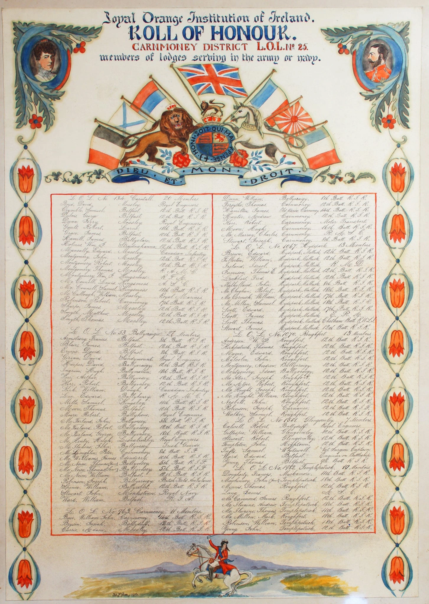
Behind every record is a person, place or community story. Select an image to view it more closely.
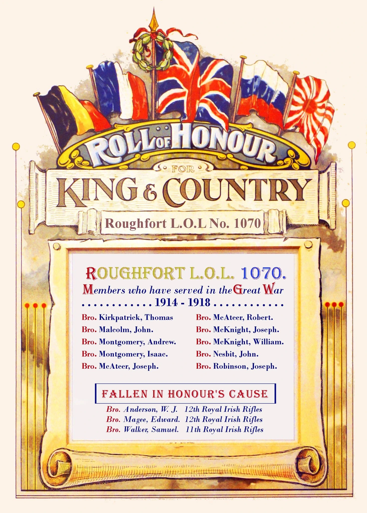
District Roll of HonourNames from across the district, including men connected with Roughfort.John Carruth memorialA surviving memorial connecting the former schoolhouse with its principal’s wartime story.Roughfort Roll of HonourA local record preserving the names of members who served during the Great War.
RHCPS works with funding bodies, community networks and partner organisations to support heritage, education, cultural activity and community development.